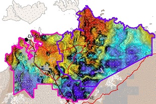
The West Arnhem region was previously covered by regional scale ground gravity data at 11km spacing as part of the Australia wide gravity data program acquired by the Bureau of Mineral Resources in 1967. Completed in late 2025, the NTGS West Arnhem Ground Gravity Survey brings the region up to the modern standard of gravity coverage with 4388 stations at 4x4 km spacing. Industry contributed funding increased resolution to 500m2 spacing in selected areas. The following 1:250 000 map sheets have been partially or fully covered: DARWIN, PINE CREEK, COBOURG PENINSULA, ALLIGATOR RIVER, MOUNT EVELYN, JUNCTION BAY, MILINGIMBI, MOUNT MARUMBA and ARNHEM BAY.
This survey, in conjunction with the recent NTGS Pine Creek Ground Gravity Survey, provides continuous coverage across more than 100,000km2 of the highly prospective Pine Creek Orogen and greater McArthur Basin. Planned for 2026, the NTGS Southern Georgina Ground Gravity Survey will complete NT-wide 4x4km ground gravity coverage, making the Northern Territory one of the few Australian jurisdictions to meet this standard of pre-competitive gravity coverage.
The NTGS West Arnhem Ground Gravity Survey was funded through the Northern Territory Government's Resourcing the Territory program and undertaken in partnership with Geoscience Australia. Improved geophysical data is a key pre-competitive dataset to support exploration and resource development in the Northern Territory Government’s drive to rebuild the economy.
Download via GEMIS: NTGS West Arnhem Ground Gravity Survey