- Home
- Resourcing the Territory
- Resourcing the Territory (2022-2026)
Resourcing the Territory (2022-2026)
From 1 July 2022, the Resourcing the Territory program secured ongoing annual funding. Resourcing the Territory [2022-2026] focused on a number of program themes designed to improve the geoscience data coverage and knowledge in targeted areas of the Northern Territory.
Providing competitive grants to stimulate exploration success
$3 millon is available annually to co-fund selected eligible industry projects that address geoscientific knowledge gaps, advance exploration activity, and support the discovery and development of resources in the Territory. For more details on the Geophysics and Drilling Collaborations (GDC) program, visit exploration grants.
Underpinning exploration success through enhanced geophysics
Geophysical data is a primary tool for area/target selection in resources exploration, improvement of the quality, accuracy, resolution, and accessibility of government-acquired and industry-submitted geophysics. NTGS is focussing on acquiring new geophysical data to improve on the existing quality and resolution of regional-scale datasets.
Improve the quality and resolution of regional-scale geophysical datasets
Improving round gravity coverage to a minimum of 4km spacing has been the focus for acquisition programs over the last several years. In 2023, the Pedirka Basin (southeastern corner of the NT) was selected for to improve regional-scale ground gravity resolution from 11 km spacing down to 2 and 4 km spacing. In 2024, the Pine Creek Orgoen was the focus of a large-scale ground gravity acquisition, reducing 11km spacing to 4km spacing with industry infill down to 500m. In 2025, ground gravity was acquired over the West Arnhem region.
Outputs
- The NTGS West Arnhem Ground Gravity Survey is complete, with 4,388 stations acquired at 500 m – 4 km spacing. Covering over 65,000 km², it spans the western Pine Creek Orogen and North McArthur Basin. Funded through the NT Government’s Resourcing the Territory program, with industry support, this dataset greatly improves on the 1967 Bureau of Mineral Resources regional gravity survey (11 km spacing). Data is available via GEMIS.
- The NTGS Pine Creek Ground Gravity Survey is complete, with 11,856 stations acquired at 500 m – 4 km spacing. Covering more than 40,000 km², the survey extends from the northwest coastline to Kakadu National Park and south to Katherine. Funded through the NT Government’s Resourcing the Territory program, with over one-third of readings supported by industry, and managed in partnership with Geoscience Australia, this dataset significantly upgrades the 1967 regional gravity coverage. Data is available via GEMIS.
- The NTGS Pedirka Ground Gravity Survey covers approximately 61,000 km², stretching from the NT–QLD–SA borders to 150 km southeast of Alice Springs. The survey comprises over 11,000 gravity stations at 2 km – 4 km spacing. Data is available via GEMIS.
- Geoscience Australia and NTGS have collaboratively acquired the Northwest Northern Territory Seismic Survey (L214) across the Birrindudu Basin and into the northern Tanami region. The survey was collected in 2023 and comprises a total of 900-line kilometres over four lines. The raw data can be requested through the Geoscience Australia's website.
Accelerating resource development in known mineral provinces
Pre-competitive geoscience projects in areas of known endowment will improve the quality and consistency of foundational geoscience datasets, including: regional-scale geophysics; stratigraphic, igneous and metamorphic frameworks; and mineral/energy systems studies where appropriate. Targeted collaboration with industry, federal agencies and research institutions, plus data and information acquired through the GDC program, will expand and enhance these projects. Areas of focus under this theme include Pine Creek Orogen and Warramunga Province (Tennant Creek area).
Pine Creek Orogen
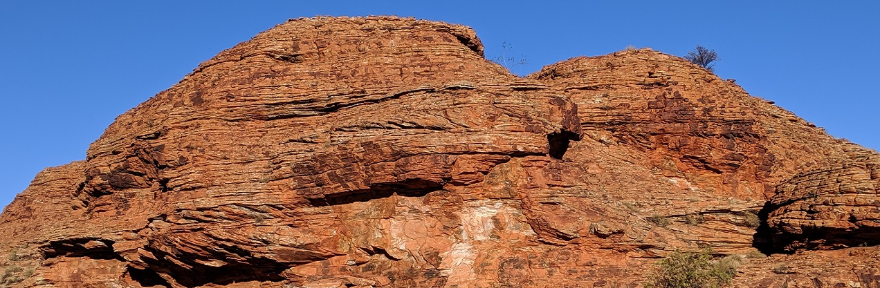
The Pine Creek Orogen, a polymetallic province with historical gold and iron ore production, is prospective for a wide range of commodities, including critical minerals as listed in the Critical Minerals of the Northern Territory.
Projects will deliver an improved knowledge of the geological framework of the Pine Creek Orogen and provide context to the diverse mineral systems and commodity potential. These projects will redefine stratigraphy and tectonic evolution, and develop understanding of the variable mineral systems of the province, plus assess the potential for secondary prospectivity at historic mines across the Pine Creek region.
Outputs
- Hyperspectral analysis at Angularli uranium deposit in the NT was released in 2025, including detailed petrography, x-ray diffraction, geochemistry and metre-spaced spectral data complemented the core logging. NTGS Record 2025-006: Hyperspectral analysis at Angularli uranium deposit, Northern Territory
- Construction of 3D geological model to reinterpret the main mineralised area of Central Domain through integration of open-file geophysical and geological data. The project is released in collaboration with the Sustainable Minerals Institute, University of Queensland. NTGS Record 2025-005: From Fold to Gold: Reinterpretation, 3D visualisation and mineral systems analysis of Pine Creek, Northern Territory
- New NTGS laser ablation ICP–MS zircon and rutile geochronology results provide significant new age constraints for the basement beneath the Birrindudu Basin. Data from drillhole LBD2 suggest that this metamorphic basement is significantly older than previously recognised, and coeval with rocks of the Pine Creek Orogen. Download through GEMIS NTGS Record 2025-003: Summary of results. NTGS laser ablation ICP-MS zircon and rutile age constraints on the basement to the Limbunya Group in drillhole LBD2.
- A new record reports on petrographic descriptions and interpretations for 42 rock samples from the Central and Litchfield domains of the Pine Creek Orogen (PCO). Two samples from drillhole LBD2 are also reported; these represent stratigraphy that may be coeval with PCO rocks beneath the Birrindudu Basin. Download through GEMIS NTGS Record 2025-001: Petrographic characterisation of samples from the Pine Creek Orogen and drillhole LBD2, Northern Territory
- Reanalysis to the full suite of 72 major and trace elements for 736 legacy Geoscience Australia igneous geochemical pulps from across the Central Domain of the Pine Creek Orogen. The ‘Compilation of pre-competitive Northern Territory Geological Survey geochemistry’ is published as DIP042.
- Assessment of secondary prospectivity of mine waste at selected sites across the Central Domain, investigating mine waste at gold and polymetallic gold deposits including NTGS Record 2023-015: Assessment of mine waste secondary prospectivity: Mount Bonnie and Iron Blow, NTGS Record 2023-014: Assessment of mine waste secondary prospectivity: Brocks Creek, NTGS Record 2024-006: Assessment of mine waste secondary prospectivity: Cosmo, Northern Territory and Mount Todd as a potential source for critical minerals. The project is being undertaken by the MIWATCH group at the Sustainable Minerals Institute, University of Queensland.
Warramunga Province
The Tennant Creek area was once the third largest gold producing region in Australia through its endowment of high-grade copper–gold bearing ironstones. The area continues to deliver new discoveries of high-grade gold deposits and copper systems, as well as indications for potential cobalt, magnetite and bismuth resources through reprocessing of existing mine waste. The prospective geology of the Tennant Creek mineral field extends under cover to the west, incorporating the copper–gold and lead–zinc potential of the Rover Field. To the east of the Tennant Creek mineral field, recent pre-competitive geoscience data from drilling funded under Geoscience Australia’s Exploring for the Future program and the Territory’s Resourcing the Territory program (2018-2022) has seen an increase in exploration in the IOCG targets concealed beneath the younger Georgina Basin.
Outputs
- An improved understanding of the geological framework and the diverse mineral potential (orthomagmatic copper–nickel, ironstone-hosted copper–gold–cobalt–bismuth and sediment-hosted lead–zinc) of the Rover field to the west. Download through GEMIS NTGS Record 2023-01: Mineral systems characterisation in the context of a new geological framework for the Rover field, Northern Territory.
- Production of a series of Mineral Deposit Atlases including a 3D compilation of available data by Sustainable Minerals Institute for the major deposits in the Tennant Creek mineral field and Rover field. DIP023 contains a regional compilation and geological interpretation of the Rover field. Mineral Deposit Atlases competed to date comprise DIP024–27, covering the Rover 1, Explorer 108, Curiosity and White Devil deposits respectively; and DIP37–40, covering Juno, Northern Star, Geko Corridor and Nobles Nob deposits respectively. series of DIPs is available to download through GEMIS.
- Compilation of industry submitted geophysics datasets across the Tennant Creek mineral field and Rover field published as DIP032, includes airborne magnetic (+/- radiometric), ground gravity, airborne electromagnetic, ground magnetic, ground electromagnetic, resistivity/induced polarisation, downhole, and other geophysical surveys.
- Assessment of secondary prospectivity of mine waste is being undertaken at selected sites within the Tennant Creek mineral field including Peko and TC8 as a potential source for critical minerals such as cobalt and bismuth. The project is being undertaken by the MIWATCH group at the Sustainable Minerals Institute.
Attracting and supporting resource exploration in frontier areas
Much of the Northern Territory remains underexplored due to the paucity of modern geoscience data. Geological mapping and the acquisition of new data to improve resolution, quality and consistency of surface and subsurface datasets aim to de-risk and attract exploration into greenfields areas. Focus areas under this theme include the greater Mcarthur Basin, Birrindudu Basin, Amadeus Basin and the NT's southeastern stacked basins.
Greater McArthur Basin
The informally named greater McArthur Basin includes Palaeo- to Mesoproterozoic successions of the McArthur and Birrindudu basins, and the Tomkinson Province. These depositional areas are interpreted to have been contiguous at time of deposition and to be interconnected at depth beneath younger cover of Neoproterozoic to Phanerozoic rocks. NTGS continues to improve the knowledge of the architecture of the stacked basin sequences, depositional history, and environment in the greater McArthur Basin, including its minerals and energy prospectivity.
Outputs
- The Mount Drummond 1: 250 000 third edition geological series map and Explanatory notes was released in 2025 via GEMIS.
- A systematic stratigraphic study of the late Palaeoproterozoic (1660–1600 Ma) Glyde package has improved stratigraphic correlation across the greater McArthur Basin. The Glyde package includes the prospective McArthur Group, host to the Pb–Zn McArthur River mine and Teena deposit plus conventional hydrocarbons. This publication complements an equivalent study on the overlying Mesoproterozoic (ca 1500–1320 Ma) Wilton package (Munson 2016) that includes the Kyalla and Velkerri formations, host to unconventional hydrocarbons. The record is available through GEMIS NTGS Record 2023-009: Stratigraphic characterisation of the Glyde package, greater McArthur Basin, Northern Territory.
- Formal definition of younger sequences (post Wilton package) in the Beetaloo Sub-basin of the McArthur Basin has allowed correlation to the Neoproterozoic stratigraphy (Kiana Group) of the overlying Georgina Basin. The record is available through GEMIS NTGS Record 2023-012: Revision of the Neoproterozoic stratigraphic nomenclature of the Beetaloo Sub-basin, Northern Territory
Birrindudu Basin
The Birrindudu Basin remains the least explored extent of the greater McArthur Basin. A range of geoscience projects will assist in extending stratigraphic correlations, basin architecture, depositional history and environment, and resource potential from the better-known eastern section of the greater McArthur Basin.
Outputs
- A new geoscientific record presents U-Pb SHRIMP zircon geochronological data from six sedimentary formations of the Birrindudu Basin in the Northern Territory. Download through GEMIS NTGS Record 2025-004: Summary of results. Joint NTGS-GA geochronology project: Birrindudu Basin.
- Geoscience Australia and NTGS have co-funded the Northwest Northern Territory Seismic Survey across the Birrindudu Basin and linked to existing seismic lines from the Beetaloo Sub-basin to the Tanami Region. The survey successfully acquired approximately 846 kilometers of high-resolution seismic data across four seismic transects: 23GA-NT1 (comprising 54.5 km and 184.5 km in two separate sections), 23GA-NT2 (112 km), 23GA-NT3 (221.46 km), and 23GA-NT4 (274.2 km) and covers an extensive area of the Birrindudu Basin, Kalkarindji Suite, Tanami, and Wolfe Basin. This is the first seismic data acquired in the Birrindudu Basin and will provide insight to the concealed relationship with the greater McArthur Basin and Tanami Region, including fault controls within the Basin. The processed data and report can be downloaded through Geoscience Australia's product catalogue.
- NTGS released a 3D data compilation across the Birrinidud Basin. DIP 043 is a 3D compilation of open-file geoscientific data for the Birrindudu Basin and its surrounds, which forms the western component of the greater McArthur Basin, Northern Territory. This compilation collates and synthesises much of the available downhole and regional geoscientific data for this frontier area into a pre-packaged 3D visualisation tool for explorers. Compiled data includes available surface and subsurface geochemistry, geophysics, geology, geochronology, SEEBASE interpretation, major structures, petrophysics and hyperspectral. The compilation encompasses 1D, 2D and 3D geoscientific datasets, accompanied by some pre-published interpretive elements. Download through GEMIS DIP043: 3D data compilation of the Birrindudu Basin, Northern Territory.
- Extensive investigations by NTGS, CSIRO, Geoscience Australia and University of Adelaide on drillholes from the Birrindudu Basin, housed at NTGS’s Core Facility in Darwin, has provided a consistent suite of information of the subsurface geology to assist in interpreting the Northwest Northern Territory Seismic Survey. These investigations include a systematic characterisation of the sedimentary facies and petrophysical signature of the Birrindudu Basin succession. Download through GEMIS NTGS Record 2023-008: Sedimentological and petrophysical characterisation of the Birrindudu Basin, Northern Territory.
- CSIRO have completed a detailed and systematic facies analysis of selected drillholes in the Birrindudu Basin. The study includes the sequence stratigraphic framework, burial history and sediment-hosted mineral potential (Cu, Zn) of the Birrindudu Basin. The NTGS Record provides a sequence stratigraphic correlation across the Birrindudu Basin, in addition to palaegeographic reconstructions of the basin’s evolution through time. Furthermore, in-depth petrographic and geochemical analyses are employed to characterise both the Birrindudu basin fill and the underlying basement for their mineralisation potential. Such reconstructions and assessments provide valuable insight for explorers into the prospectivity for sediment-hosted mineralisation across this frontier and underexplored basin, a highly useful tool in refining future resource exploration programs. Download through GEMIS NTGS Record 2024-004: Sedimentology and mineral potential of the Birrindudu Basin, Northern Territory.
- Partner releases include fluid inclusion petrography and microthermometry for selected drillholes; stratigraphic reconstructions of bulk volatile chemistry from fluid inclusions; plus geochronology of targeted formations.
Aileron Province
A focus on updating the geological framework of the polymetallic eastern Aileron and Irindina provinces follows on from work from the Resourcing the Territory 2018-2022 initiative, with geoscience outcrop mapping across the northeastern Aileron Province.
Outputs
- The Huckitta 1:250 000 third edition geological series map and Explanatory notes. were released in 2025 via GEMIS.
- The Jinka 1:100 000 first edition geological map series and Explanatory notes were released in late 2022 via GEMIS.
Amadeus Basin
Whilst the Amadeus Basin has produced oil and gas for over 30 years, it remains under explored for sediment-hosted mineral systems. In addition, with the move to a low emission’s future, indications of the Amadeus Basin’s naturally occurring hydrogen and critical resource helium, plus potential geological storage opportunities presented by the extensive salt bearing formations, has renewed exploration focus on this Basin. Much of the Amadeus Basin has not been systemically mapped since the first edition BMR geological series maps from the 1960s. NTGS is undertaking a systematic updating of the 1:250 000 geological series outcrop maps to revise the stratigraphy seamlessly across the Basin.
Outputs
- The Henbury 1: 250 000 second edition geological series map and Explanatory notes was released in 2023 via GEMIS.
- Geological outcrop mapping will continue across the remaining Amadeus Basin with mapping on the 2nd edition Rodinga 1:250 000 geological series mapsheet, which will also culminate in the release of the East Amadeus Basin 1:500 000 interpreted geology map.
- Through collaboration with University of Adelaide, novel isotopic dating techniques will provide improved accuracy in constraining depositional age of formations within the eastern Amadeus Basin and assist with correlating stratigraphy across the Basin.
Warburton/Pedirka/Eromanga basins
The stacked Palaeozoic basins in the southeast corner of the Northern Territory are mostly concealed beneath Quaternary sediments and hence, are underexplored. In collaboration with Geoscience Australia, through the Australia’s Future Energy Resources project under the Exploring for the Future program, and with the South Australia Department of Energy and Mines, NTGS has undertaken new data acquisition and targeted studies to improve knowledge of the framework and resource potential of these stacked basins.
Outputs
- New geochronology has indicated correlation between the Cambrian–Ordovician strata of the Amadeus Basin, Warburton Basin and Thomson Orogen in Queensland. This record is avilable through GEMIS.
- Petroleum geoscience data compiled from 1537 samples within the stacked west Warburton, Pedirka and Eromanga basins is published as DIP034.
- The lithostratigraphy of the Perdirka Basin has been significantly updated and available to download through GEMIS. An assessment of the petroleum systems in the Perdirka Basin within the Northern Territory has identified good to excellent source rocks, excellent reservoirs and fair to good seals. This abstract is available through GEMIS.
- To complement the reprocessed 2D seismic over the Pedirka–Simpson Basin across the Northern Territory and Queensland border undertaken by Geoscience Australia (2022) through the Exploring for the Future program, NTGS has acquired 2 to 4 km-spaced ground gravity through the Pedirka Ground Gravity Surve, available to download through GEMIS.
- This work culminated in the release of DIP044: Warburton-Pedirka-Eromanga basins SEEBASE update which is available via GEMIS.
Applying geoscience to support a low emissions future
NTGS is building knowledge on the NT’s potential for commodities to support emerging and low-emissions industries.
NTGS is commissioning a series of products to assess the Northern Territory’s potential for geothermal energy through Hot Dry Rocks Pty Ltd, and to assess the capacity for geological storage of carbon, hydrogen and compressed air in selected Northern Territory onshore basins through CSIRO.
Collaborative research projects are proposed with the University of Adelaide and University of Western Australia to improve our understanding of key critical minerals, including understanding of lithium–caesium–tantalum (LCT) pegmatites in the Pine Creek Orogen, Aileron and Irindina provinces; cobalt- and bismuth-rich systems in the Tennant region; and potentially rare earth elements within phosphorites in the Georgina Basin.
Outputs
- The record assessing selected onshore basins for geological storage potential is available to download through GEMIS, NTGS Record 2024-005: CO2, H2 and compressed air energy storage site screening study - selected onshore basins in the Northern Territory
- The report assessing the prospectivity for geothermal power generation in the Northern Territory is available to download through GEMIS, NTGS Report 23: Prospectivity for geothermal power generation in the Northern Territory
Modernising geoscience data to support a digitally enabled industry
NTGS is undertaking projects to ensure our data is easily accessed and extensively used, facilitating increased resource exploration and investment.
Findable Accessible Interoperable Reusable (FAIR) principles inform decision making
Work is underway to implement FAIR principles across the acquisition and delivery of online systems and databases.
Industry data capture
The major program to capture all remaining legacy open-file exploration drilling and geochemistry data across the Northern Territory (NT), commenced with the McArthur Basin, Tennant Creek and Barkly regions, and has moved into the Pine Creek Orogen.
The captured data is providing explorers with immediate access to a complete and spatially located dataset of all historic drilling and geochemistry in the area. This is an important pre-competitive dataset to allow industry to rapidly assess and interpret past exploration in the area. With data capture across the Tennant Creek, Barkly and Gulf regions nearly complete, the program is now focussing on the Pine Creek region.
Data is progressively released as part of the Territory-wide Drilling and Geochemistry GIS datasets available for download in MapInfo tab, KML, ESRI shapefile and csv file formats through STRIKE, the NTGS Digital Information Package DIP001 or via the NT-wide geoscience datasets webpage.
Promoting the Territory’s prospectivity and investment potential
NTGS is undertaking engagement activities to support exploration industry growth and increased resource development.
AGES
NTGS hosts the Territory's premier technical exploration conference Annual Geoscience Exploration Seminar (AGES) held every April in the Alice Springs.
Events and presentations
To find out more about NTGS presence and participation at other events, visit events and presentations.
Resource potential
NTGS promotes the mineral and energy potential of the Territory with up-to-date news, factsheets, data and publications and industry activity.
Other useful quick links
NT commodity factsheets, maps and posters
NTGS provides high-quality geoscience data and publications free-of-charge to explorers through GEMIS and STRIKE.