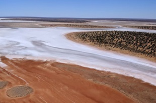
NTGS has released the second edition 1:250 000 Lake Amadeus geological map series. The LAKE AMADEUS map area west of Alice Springs includes Watarrka National Park, part of the Mereenie oil and gas field, as well as the salt lake of Lake Amadeus. The second edition map is the result of the first regional-scale mapping conducted in the area since the 1960s. Geological field mapping in this area of the Amadeus Basin has contributed to a revised understanding of the Neoproterozoic stratigraphy. The new map provides a modern geological framework that can be integrated with additional digital datasets.
The Lake Amadeus Second Edition 1:250 000 geological map, associated GIS data, and explanatory notes are available for download from GEMIS:
- Lake Amadeus 1:250k map and GIS (Second Edition) via GEMIS
- Lake Amadeus 1:250k explanatory notes via GEMIS
Previous AGES abstracts and presentations outlining key findings from the Amadeus Basin mapping program are also available. to download from GEMIS: