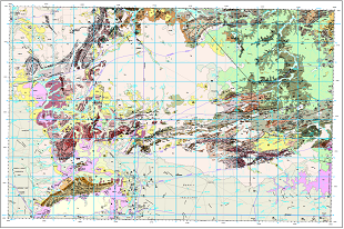
The latest release from the Northern Territory Geological Survey (NTGS) unveils nearly 1.9 billion years of geological history preserved in the Mount Drummond area, near the Queensland border in the gulf country of the Northern Territory.
Developed in collaboration with Geoscience Australia, the Third Edition of the 1:250,000 geological map and explanatory notes for Mount Drummond integrates new mapping conducted between 2017 and 2019. This revision significantly refines the region’s stratigraphy, incorporating findings from the first -ever seismic surveys undertaken in the area plus extensive geochronological investigations, all acquired under Geoscience Australia’s Exploring for the Future program.
One of the most significant changes is the expanded representation of the Palaeoproterozoic Lawn Hill Platform sequences across central-northwest and northwest Mount Drummond. These sequences are age-equivalents of resource-rich units of the McArthur Group of the southern McArthur Basin.
The map sheet includes 42 newly defined or redefined stratigraphic units spanning the Murphy Province, overlying Lawn Hill Platform, Mesoproterozoic South Nicholson Basin, and Neoproterozoic–Cambrian Georgina Basin.
Mount Drummond remains prospective for commodities including manganese, base metals, iron, diamonds, phosphate, and hydrocarbons. Significant Cambrian phosphorite deposits and organic-rich source rocks of the McNamara and South Nicholson groups further highlight the area’s energy and resource potential.
Access now via GEMIS:
Mount Drummond, Northern Territory (Third Edition). 1:250 000 geological map and GIS.
Mount Drummond, Northern Territory (Third Edition). 1:250 000 geological map explanatory notes