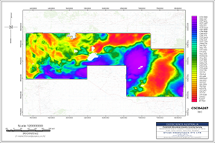
The final processed data, images, grids and documentation for the NTGS Brunette Downs Ground Gravity Survey has been released. The survey was funded under the Northern Territory Government’s Resourcing the Territory 2018–2022 Initiative and the project was managed by Geoscience Australia. The survey covers an area of around 57,000 square kilometres located just north of Tennant Creek and extending to the Northern Territory - Queensland border. The survey infills existing 4 km gravity coverage to 2 km coverage. NTGS partnered with industry to acquire higher resolution data at 1 km x 1 km and 500 m x 500 m spacing over smaller areas within the survey. The data package consist of 17 312 gravity stations as a point located dataset and grids of the newly acquired gravity data.
The preliminary data was being released as acquired and is now replaced by the final processed data. The final data has undergone Geoscience Australia's quality control and assurance process.
Download the final NTGS Brunette Downs Ground Gravity Survey data though our FTP site.
View further information on upgrading geophysical data coverage under the Resourcing the Territory initiative.


