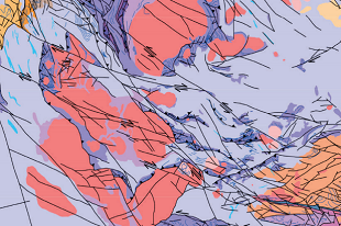
The CSIRO-NTGS Tanami Project: aeromagnetic interpretation of the Tanami Region has been released as two digital information packages (DIPS).
The project involved processing and interpreting the NTGS Tanami Region: magnetics and radiometrics survey with pre-existing geophysical surveys to produce a new seamless geological interpretation of the 1:250,000 TANAMI and THE GRANITES map sheets, as well as parts of the MOUNT THEO, MOUNT SOLITAIRE and HIGHLAND ROCKS maps sheets.
A total of 72 aeromagnetic, 32 radiometric and 2 gravity surveys acquired by industry were processed together with both new and legacy regional geophysical surveys acquired by government.
Both DIPS contain the report on the aeromagnetic interpretation of the Tanami Region. DIP021 also includes all the related GIS. DIP022 comprises all the related geophysical data and due to its large size, will need to be requested through the GEMIS link.


