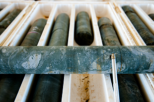
The latest release of legacy drilling and geochemistry has digitally captured data from 235 company reports from across the Walhallow 1:250k map sheet, covering the southern margin of the outcropping McArthur Basin and the northern Barkly Tableland. This data includes 1,196 drillhole collars, with 6,486 down-hole samples with geochemical results. A further 16,694 surface samples and associated geochemical assays have been captured and spatially geolocated. Surface sampling includes stream sediment, soil and rock chip samples.
Since the Resourcing the Territory initiative commenced, legacy data has been captured from 2,967 company reports, with 116,436 drillhole collars, 529,429 drillhole samples and 234,205 surface geochemical samples added to the Northern Territory Geological Survey (NTGS) Drilling and Geochemistry database.
NT Surface Sample Geochemistry and Drillhole Locations are provided for download in MapInfo tab, KML, ESRI shapefile and csv file formats from the STRIKE website.