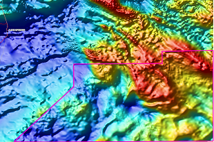
The NTGS Pedirka Ground Gravity Survey has improved resolution from 11 km grid spacing down to 4 km grid spacing with some areas of 2 km grid spacing funded by both NTGS and industry partners. The newly acquired gravity data data package consists of 11,440 gravity stations as a point located dataset and grids. The gravity survey spans an area of approximately 61,000 km2 and covers parts of the following 1:250 000 map sheets in the Northern Territory: HALE RIVER, SIMPSON DESERT NORTH, FINKE, MCDILLS, and SIMPSON DESERT SOUTH.
The survey was funded under the Northern Territory Government’s Resourcing the Territory initiative and the project was managed by Geoscience Australia on behalf of the NTGS.
Donwload the data through GEMIS.


