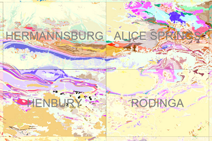
The Territory’s 1:250 000 geology map series GIS products are now available in a single downloadable product. The latest editions of 1:250 000 geology map series GIS datasets are combined into a single GIS layer with internally consistent formats. These are provided as Esri ArcGIS Pro project/geodatabase format, MapInfo TAB files and Esri Shape files, released as Digital Information Package (DIP) 041.
This product includes the GIS datasets from the current published 1:250 000 geology map series presented in the datum GDA 1994 (EPSG: 4283) and a report containing the methodology of the compilation. The original mapsheets have been published from the 1960s up to 2023 and thus contain a wide range of approaches and were published in various projections and datum. No edge matching has been attempted during the compilation.
The major benefit of the compilation being that the 88 mapsheet GIS are available as single NT-wide datasets that have a standard structure and improved consistency within the attribution.
Download DIP041 through GEMIS.


