A major program funded under the Resourcing the Territory initiative is the capture and release of legacy exploration data from across the Territory.
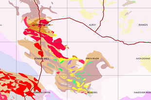
The latest release comprises legacy drilling and geochemistry geolocated data digitally captured from 103 company reports from across the Bonney Well 1:250 000 map sheet covering the southern Tennant Creek and Barkly Region. This data includes 2,959 drillhole collars, with 15,190 down-hole samples with geochemical results. A further 7,032 surface samples (stream sediment, soil and rock chip) including associated geochemical assays have also been captured.
Since the Resourcing the Territory initiative commenced, legacy data has been captured from 3,304 company reports, with 123,372 drill hole collars, 579,427 drill hole samples and 263,554 surface geochemical samples added to the Northern Territory Geological Survey (NTGS) Drilling and Geochemistry database.
NT surface sample geochemistry and drillhole locations are provided for download in MapInfo tab, KML, ESRI shapefile and csv file formats from the STRIKE website.