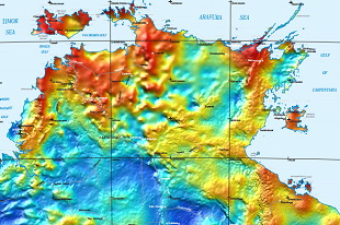
Northern Territory Geological Survey (NTGS) is pleased to announce new Territory-wide gravity products, including grids and a printable map. The new products incorporate the recently released regional ground gravity surveys, East Tennant and South West McArthur-Barkly gravity surveys, funded through Geoscience Australia’s Exploring for the Future program and NTGS’s Resourcing the Territory 2018–2022 initiative (South West McArthur–Barkly gravity survey only).
A total of 218 155 ground gravity stations from government and industry surveys were used to generate the grids, which have a cell size of 250 m and are published in ER Mapper format. Bouguer Anomaly and standard derivatives are available.
Geophysical data is widely recognised as an important tool for mapping, resource exploration and land management. Geophysical grids allow users to get more from the geophysical data than map or image products. The grids will allow users with the appropriate software to produce customised geophysical imagery and derivatives or model the data.
Download the grids and input gravity data here and the map here.